Hyperspectral imaging for multiscale assessments of marine litter and plastic pollution
The main objective of this master thesis is to investigate the application of hyperspectral imagery for detecting marine litter and plastics in the coastal zone near Oslo and other regions of Norway coordinated with a beach clean-up initiative.

Plastic and chemical pollution has become the fifth largest global planetary threat, a threat growing at such a rate that it exceeds current monitoring capabilities. Over the past decade, there have been substantial technological advancements in space and airborne hyperspectral imaging (HSI) with potential widespread applications for pollution detection and monitoring.
NGI has continued to scale research related to environmental and pollution assessments but has not explored large-scale monitoring of pollution and land-use change through satellite and drone-based data beyond a few small efforts.
The assignment
We propose to investigate the application of hyperspectral imagery for detecting marine litter and plastics in the coastal zone near Oslo and other regions of Norway coordinated with a beach clean-up initiative.
Laboratory-based hyperspectral measurements of collected marine litter items and pure plastic polymers have already been acquired. They are currently available as training datasets for developing algorithms to be applied to larger-scale Drone and Satellite imagery.
We will test and develop data acquisition protocols and processing pipelines (including Machine Learning and Deep Learning algorithms) and identify essential spectral wavelength regions for the detection and mapping of land-based and marine pollution to investigate possible applications, necessary equipment specifications, and approaches to pursue in future EU and NFR proposals.

During this project, the student will learn how to:
The student will explore laboratory hyperspectral measurements of marine litter and plastic polymers to develop various classification algorithms using a combination of spectral mixture analyses, spectral indices and band ratios, machine learning and deep learning methods.
These algorithms will then be applied to selected airborne datasets. Participation in field data collection (e.g., drone surveys and marine litter clean-up events) is also encouraged, but it depends on timing.
Potential HSI datasets
Potential HSI datasets will be acquired from:
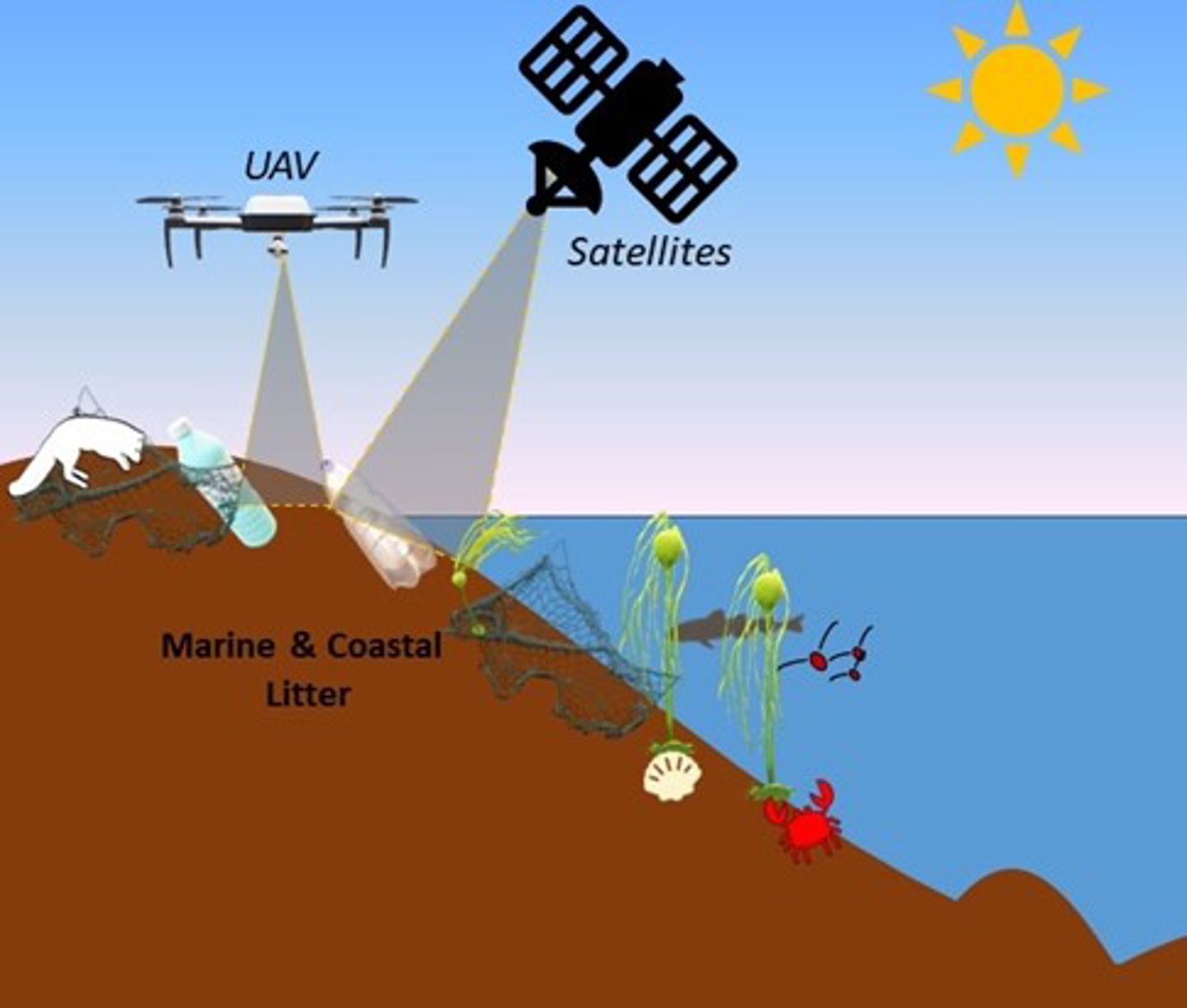
- satellites (e.g., EnMAP: DLR, Germany Space Agency; or PRISMA: ASI, Italian Space Agency) and
- drone imagery by the new M300 NGI drone and hyperspectral imager.
Mapping marine litter along beaches will allow the comparison with satellites to test the potential size detection limits for EnMAP and PRISMA data.

Benjamin Allen Lange
Senior Scientist & Research Advisor Remote Sensing and Geophysics benjamin.lange@ngi.no+47 938 71 440